


Background
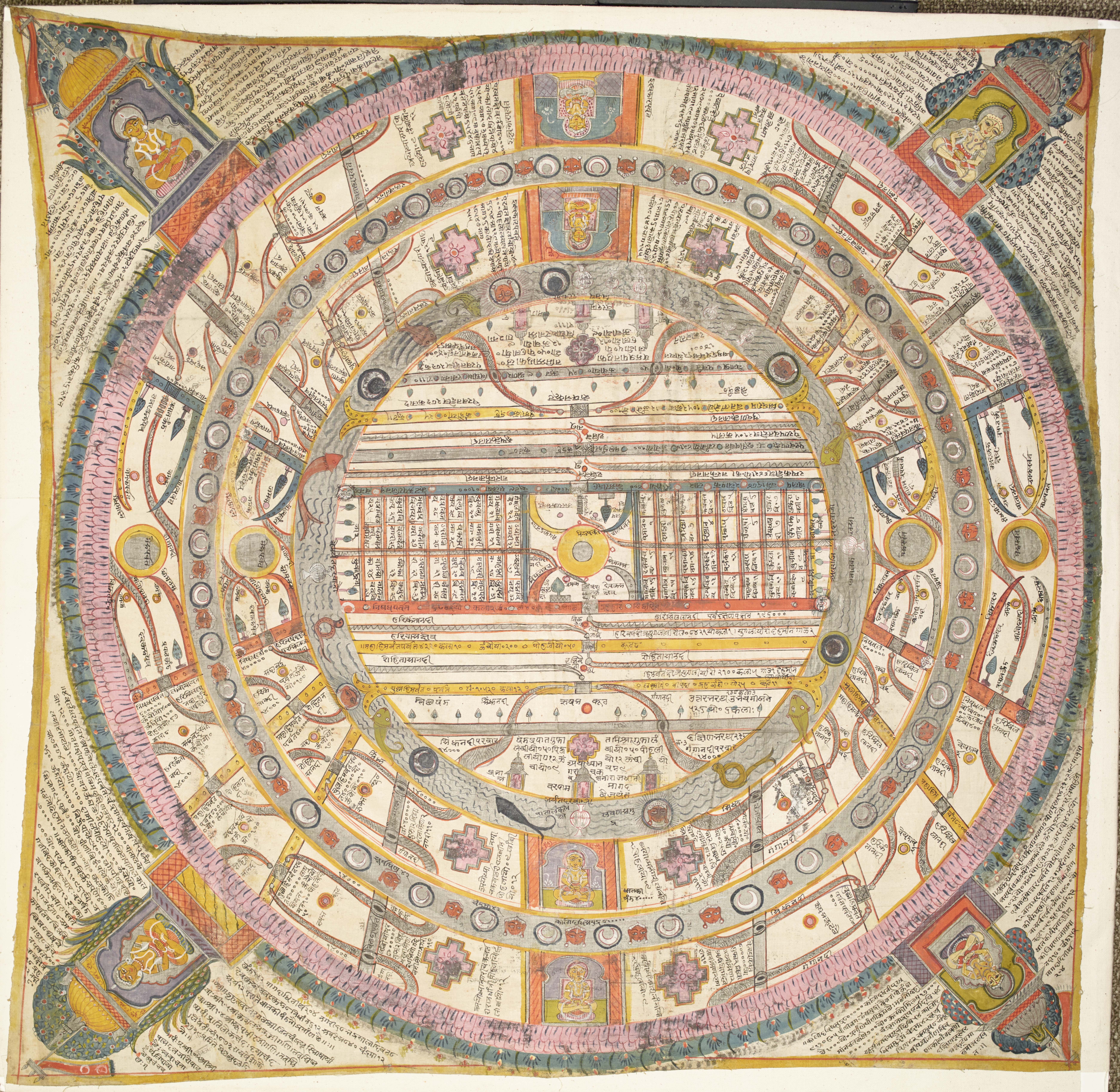
Aḍhāī-dvīpa is the Hindi phrase for 'Two and A Half Continents' and describes the only part of the universe where human beings live in the Middle World of Jain cosmology. Frequently depicted in maps or colourful diagrams, it is the only part of the universe where people can be born so it is also known as 'the World of Humans' – manuṣya-loka.
The Two and A Half Continents is formed of concentric rings of differing size. Every other ring is a continent, which is surrounded by a ring of ocean. Moving from the centre outwards, the order is as follows:
- the central continent, called Jambū-dvīpa
- the first ocean, known as Lavaṇa-samudra or 'Salt-Ocean'
- the second continent, Dhātakīkhaṇḍa
- the second ocean, called Kālodadhi or 'Black-water Ocean'
- half of the third continent known as Puṣkara-dvīpa.
Mount Meru is the centre of the universe in Jain cosmology, at the heart of the central continent of Jambū-dvīpa. Jambū is where human beings live and is in the Middle World, one of the three worlds of traditional Jain cosmology.
The Middle World is the smallest of the three worlds that make up world space – loka-ākāśa. In world space all the souls live in the different body-forms they take according to their rebirths, in the various worlds. Outside world space is the non world space – aloka-ākāśa – which is endless. However, the Middle World is the most important area from the spiritual point of view because it is the only part where human beings can live.
Pictures in cosmological works are not intended to be merely attractive. Spelling out in visual form the complex explanations found in the writings, cosmological paintings form a long-established tradition of artwork in Jain heritage.
Jains cannot advance spiritually without understanding and meditating upon cosmological theories so understanding them is crucial. Certain key religious concepts run through these theories. These include the notion of a physical soul shedding karma by moving through the cycle of rebirth to eventual omniscience and final liberation, along with the cyclical nature of time, the interconnectedness of the universe, and the importance of symmetry, repetition and balance.
Glossary
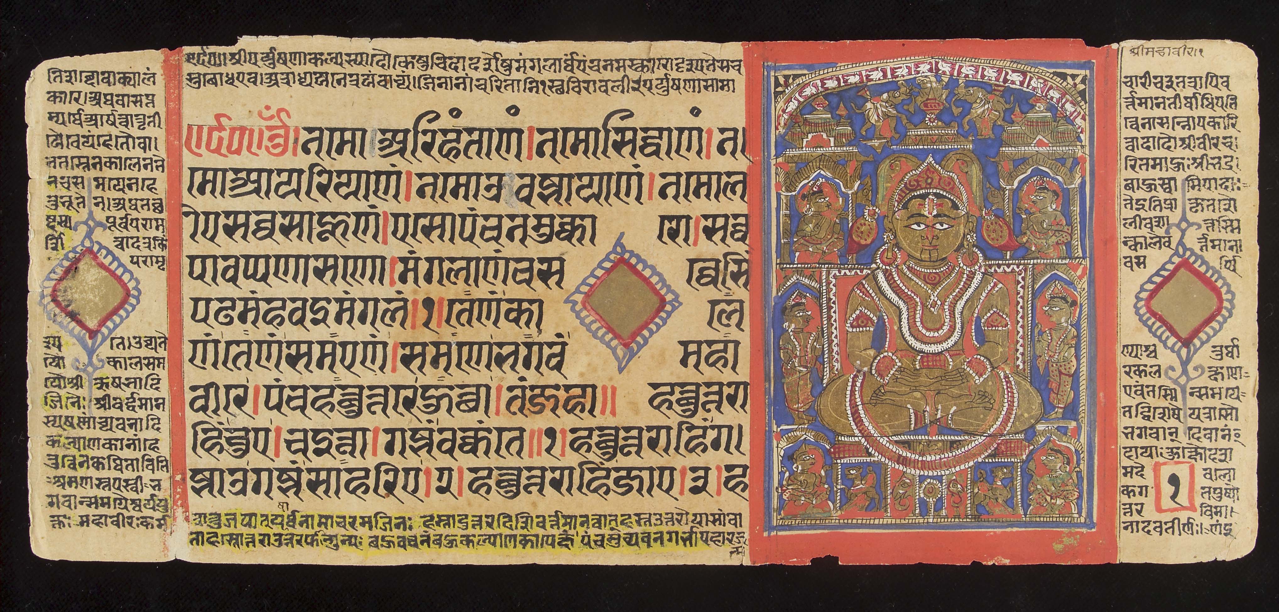
Description
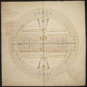
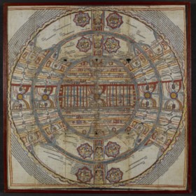
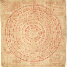
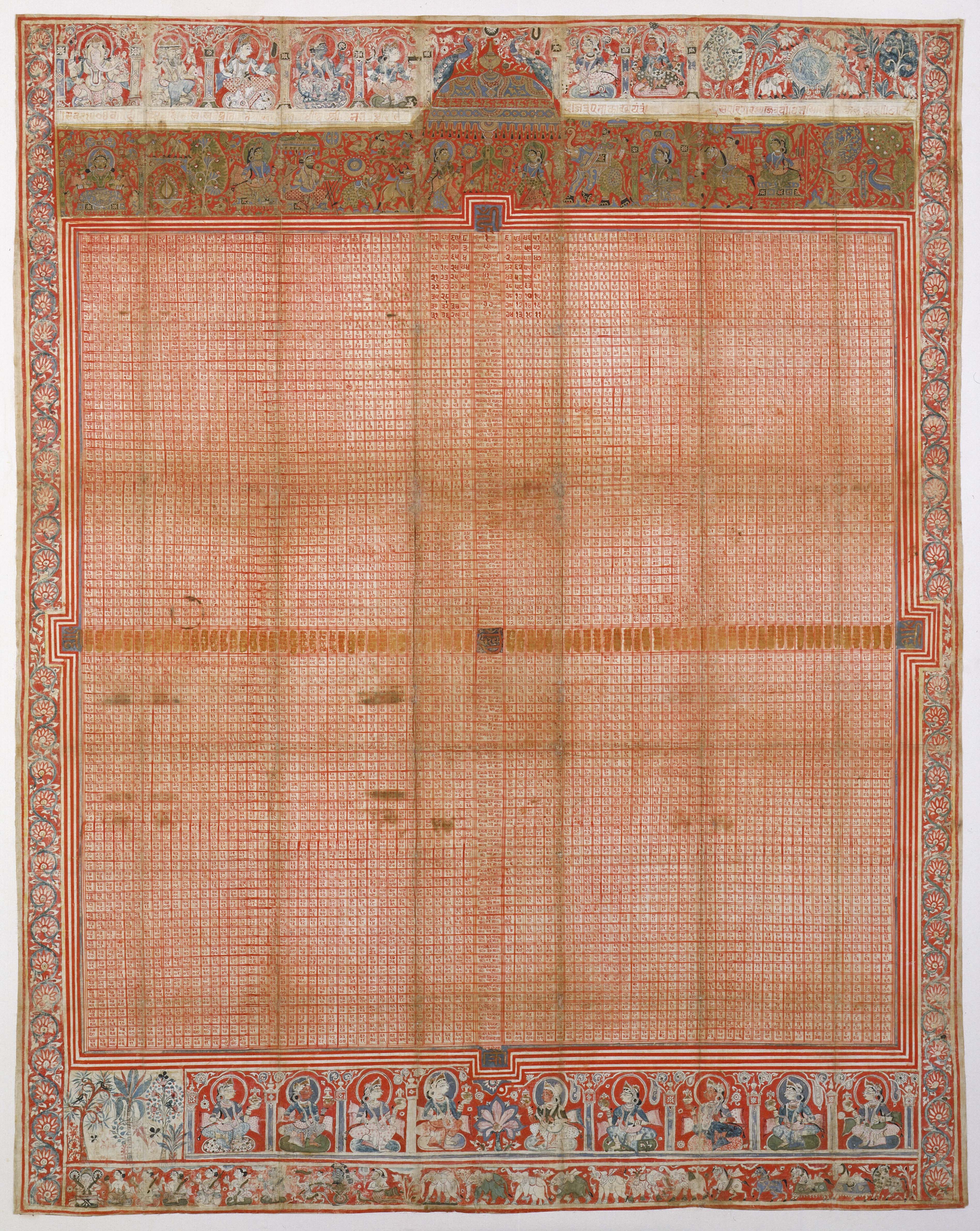
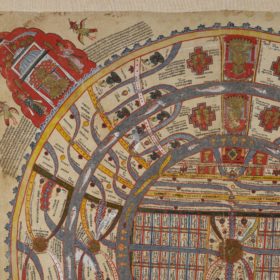
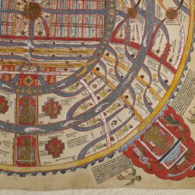
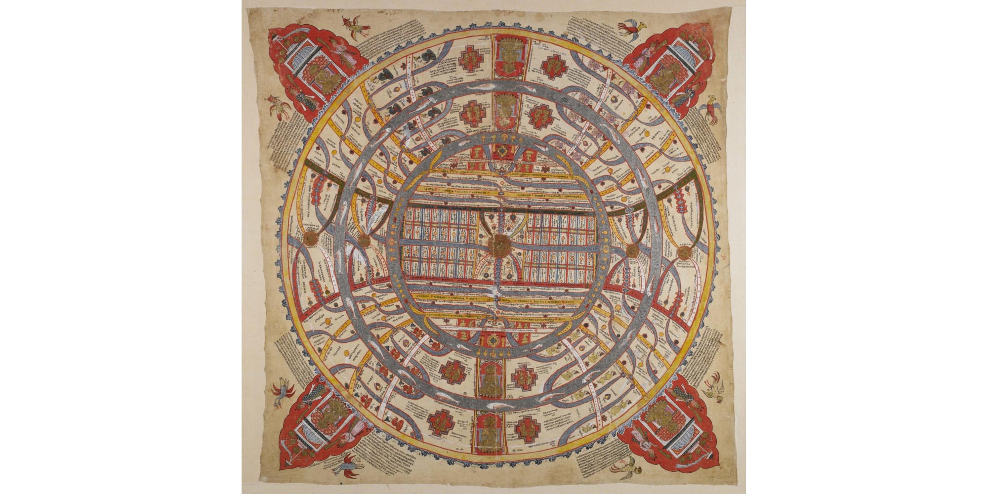
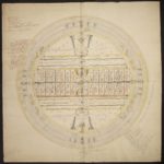
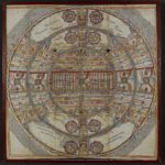
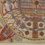
This is the traditional representation of the world inhabited by human beings in Jain cosmology. It is made up of alternate concentric rings of continents, mountains and oceans.
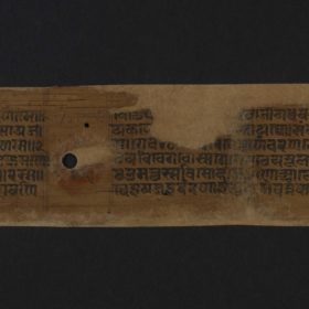
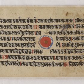
Like any map, this one has captions, which are of two types:
- geographical features, for example nadī for 'river'
- proper names, for example Harīsalīlā and Harīkaṃtā are names of rivers while Vaitāḍhya is the name of a mountain.
Each part of the Jain world has named rivers, mountains, towns, caves and so on. Since symmetry and repetition are two of the major organising principles of the Jain world, the names are often the same in different regions.
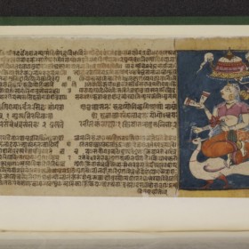
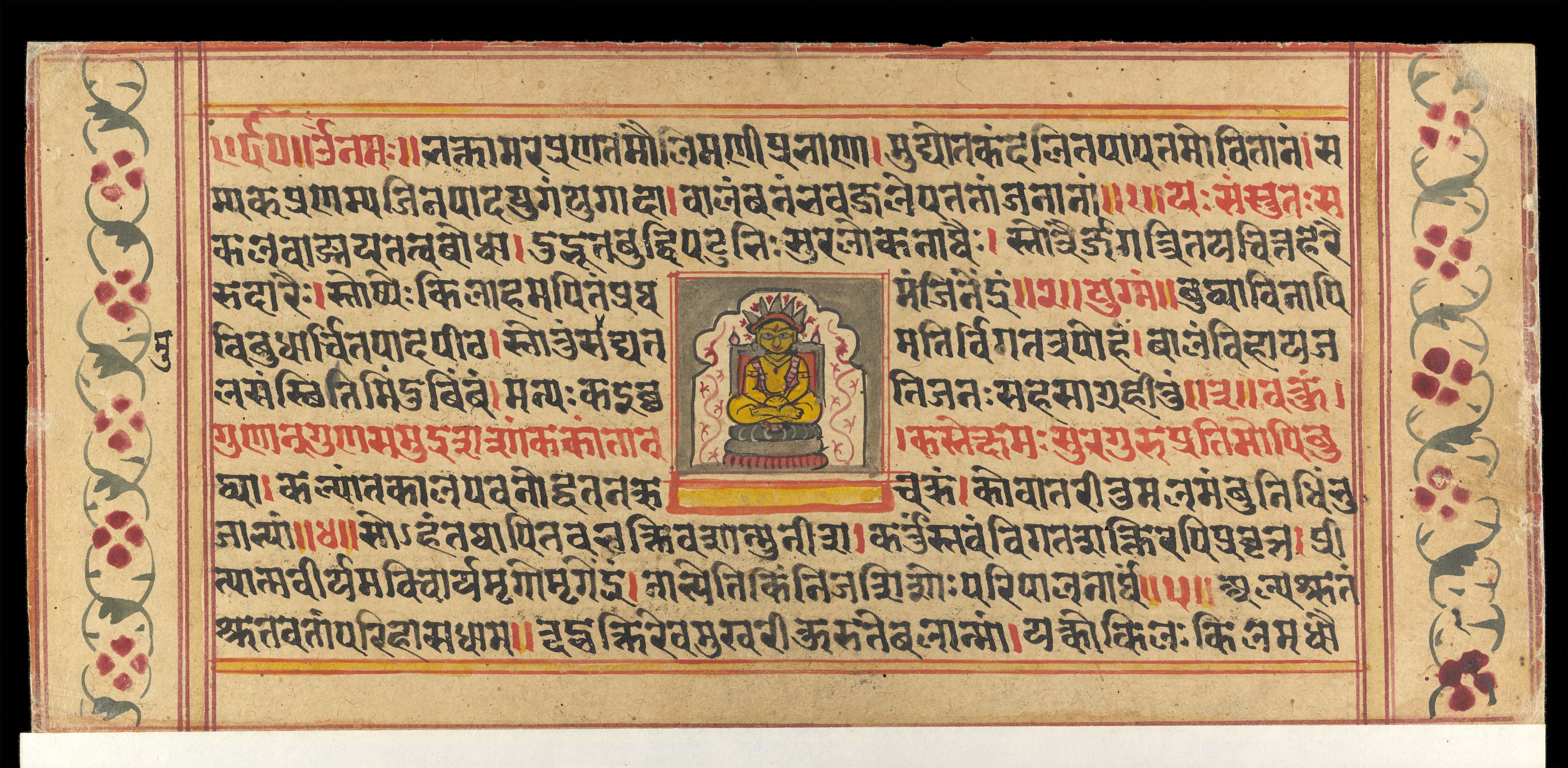
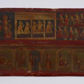
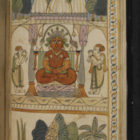
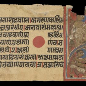
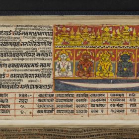
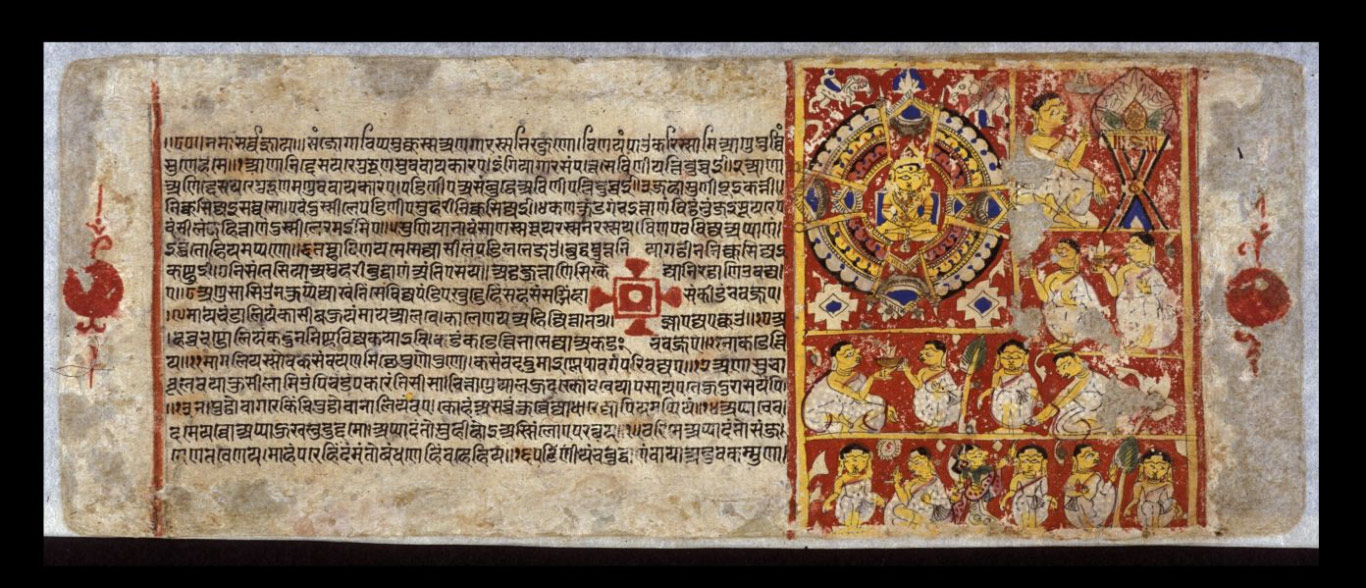
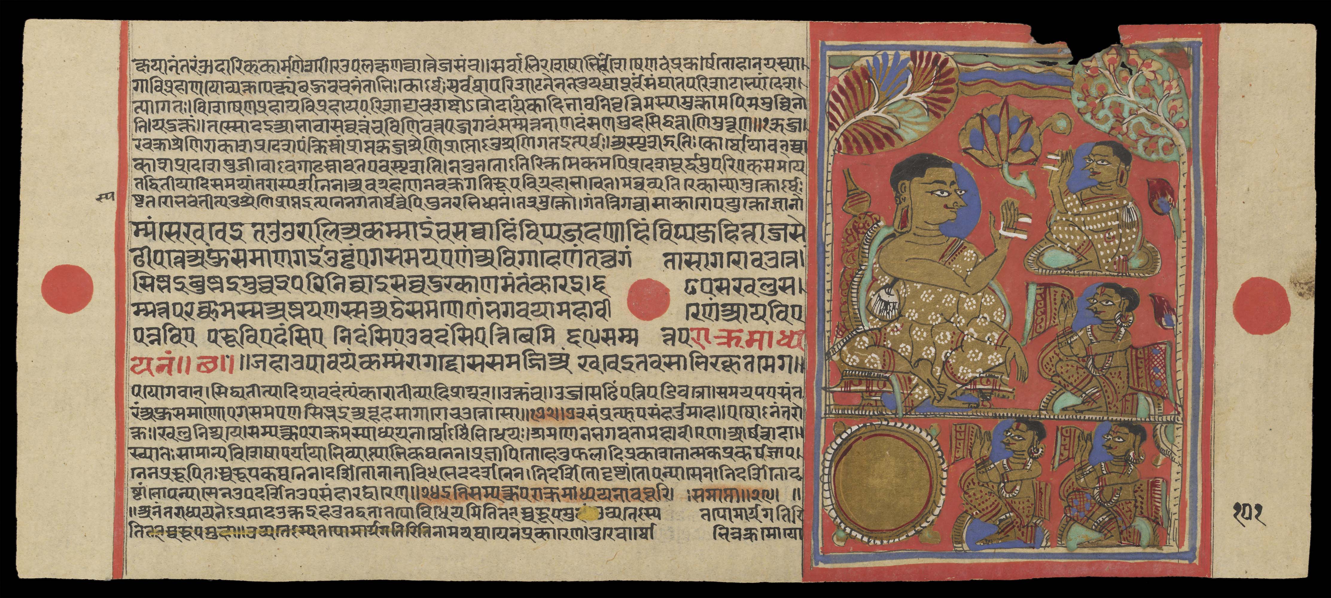
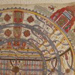
At each of the four angles of the picture is a Jain temple with worshippers. This is intended to show that the Jinas' teachings are everywhere in the world.
On each side of these temples, there are lines of text written in small script. They provide additional detail about the Jain universe, describing each component, giving dimensions and occasional quotations from scriptures.
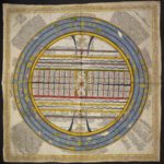
Two and A Half Continents
The outermost yellow ring is a mountain range called Mānuṣottara. It symbolises the limit beyond which human beings cannot live.
The two textured grey rings represent two oceans. The innermost one is the ocean called Lavaṇa-samudra or 'Salt Ocean'. The second one is Kālodadhi or 'Black-Water Ocean'.
The three spaces in between these three rings form the human world, which is called Aḍhāī-dvīpa or 'Two and A Half Continents'. Starting from the centre, they are:
- Jambū-dvīpa or 'Rose-apple Tree Island'
- Dhātakikhaṇḍa
- Puṣkara-dvīpa or 'Lotus Island', half of which is in the world of humans while half is the other side of the mountain range marked by the red circle. This is why the complete map of the human world is called 'Two and A Half Continents'.
The thick red vertical line divides the Dhātakīkhaṇḍa and the Puṣkara-dvīpa into two halves, eastern and western. There are four Jinas sitting along the line. The four segments of this line on land represent a mountain range known as Iṣvākāra or 'Arrow Shaped' because it is perfectly straight. Its name is written on the lowest segment.
The five dark gold disks going horizontally across the centre represent the central mountain called Mount Meru. The Jambū-dvīpa has one in its middle while both the two other continents have identical Mount Merus in each half.
Either side of each Mount Meru are two semicircles, indicated by one green and yellow line, the other a red and white line. They are the boundaries of two regions. The northern one is called Uttara-kuru, the southern one Deva-kuru. These regions are the Lands of Enjoyment, where people get all they need from 'wishing trees' – kalpa-vṛkṣa – and do not need to make any effort. Couples made up of twin boys and girls live in the Lands of Enjoyment.
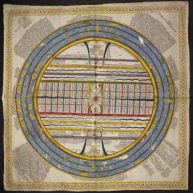
Jambū-dvīpa
The first continent, in the centre, is Jambū-dvīpa. It is divided into parts separated by mountain ranges.
From north to south there are eight mountain ranges. They are shown as double horizontal lines as they cross the Jambū-dvīpa from east to west. Here, the first and eighth are not coloured. The second, third, sixth and seventh are coloured in yellow. The most conspicuous on all maps are the fourth and fifth, respectively always green and red.
The names of all these mountains are not given in this map, but they are well known among Jains. Between these mountain ranges are seven regions.
Across the centre of Jambū is a large rectangular strip marked out by a green line in the north – the Nīla mountain range – and a red one in the south – the Niṣadha mountain range. This is the Mahā-videha with Mount Meru at its centre. The Mahā-videha is a land of wonders, where Universal Monarchs go and where Jinas preach.
The Mahā-videha is divided into 32 provinces, distributed as eight groups of four, equally in the north-east, south-east, north-west and south-west. They are always shown as small rectangles, like here.
Lavaṇa-samudra
The first ocean, starting from the centre, is the thick grey ring around Jambū. Called Lavaṇa-samudra, it has sets of pots in each of the four directions. These are the 'great receptacles' – pātāla-kalaśa – that cause the tides.
There are two horizontal yellow lines ending with double hook shapes shown in the north and south of this ocean. These are two mountain chains that end with double pairs of 'tusks' jutting out into Lavaṇa-samudra. These tusks carry the 56 islands known as Antara-dvīpas. The islands are divided into seven groups of eight, although they are not shown on this map.
Everywhere on this map, a multitude of grey rivers flows and irrigates the land. Small yellow circles are the islands of the moons and the suns, which vary in number from place to place.
- Source:
The British Library Board
- Shelfmark:
Or. 13937
- Author:
unknown
- Date of creation:
perhaps 18th to 19th centuries
- Folio number:
not applicable
- Total number of folios:
not applicable
- Place of creation:
western India
- Language:
Sanskrit and Gujarati in Devanāgarī script
- Medium:
painting on cloth
- Size:
90 x 90 cms
- Copyright:
CC0 1.0 (Creative Commons Public Domain)
- Image Copyright:
World of mortals
- Source:
The British Library Board
- Shelfmark:
Or. 13937
- Author:
unknown
- Date of creation:
perhaps 18th to 19th centuries
- Folio number:
not applicable
- Total number of folios:
not applicable
- Place of creation:
western India
- Language:
Sanskrit and Gujarati in Devanāgarī script
- Medium:
painting on cloth
- Size:
90 x 90 cms
- Copyright:
CC0 1.0 (Creative Commons Public Domain)
- Image Copyright:

Description
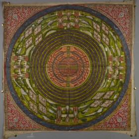
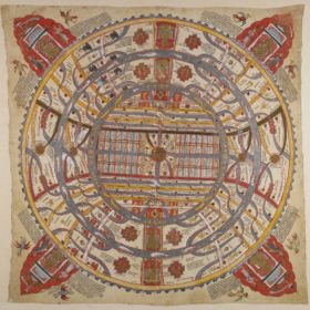
This is the traditional representation of the world inhabited by human beings in Jain cosmology. It is made up of alternate concentric rings of continents, mountains and oceans.
Like any map, this one has captions, which are of two types:
- geographical features, for example nadī for ‘river’
- proper names, for example Harīsalīlā and Harīkaṃtā are names of rivers while Vaitāḍhya is the name of a mountain.
Each part of the Jain world has named rivers, mountains, towns, caves and so on. Since symmetry and repetition are two of the major organising principles of the Jain world, the names are often the same in different regions.
At each of the four angles of the picture is a Jain temple with worshippers. This is intended to show that the Jinas‘ teachings are everywhere in the world.
On each side of these temples, there are lines of text written in small script. They provide additional detail about the Jain universe, describing each component, giving dimensions and occasional quotations from scriptures.
Two and A Half Continents
The outermost yellow ring is a mountain range called Mānuṣottara. It symbolises the limit beyond which human beings cannot live.
The two textured grey rings represent two oceans. The innermost one is the ocean called Lavaṇa-samudra or ‘Salt Ocean’. The second one is Kālodadhi or ‘Black-Water Ocean’.
The three spaces in between these three rings form the human world, which is called Aḍhāī-dvīpa or ‘Two and A Half Continents’. Starting from the centre, they are:
- Jambū-dvīpa or ‘Rose-apple Tree Island’
- Dhātakikhaṇḍa
- Puṣkara-dvīpa or ‘Lotus Island’, half of which is in the world of humans while half is the other side of the mountain range marked by the red circle. This is why the complete map of the human world is called ‘Two and A Half Continents’.
The thick red vertical line divides the Dhātakīkhaṇḍa and the Puṣkara-dvīpa into two halves, eastern and western. There are four Jinas sitting along the line. The four segments of this line on land represent a mountain range known as Iṣvākāra or ‘Arrow Shaped’ because it is perfectly straight. Its name is written on the lowest segment.
The five dark gold disks going horizontally across the centre represent the central mountain called Mount Meru. The Jambū-dvīpa has one in its middle while both the two other continents have identical Mount Merus in each half.
Either side of each Mount Meru are two semicircles, indicated by one green and yellow line, the other a red and white line. They are the boundaries of two regions. The northern one is called Uttara-kuru, the southern one Deva-kuru. These regions are the Lands of Enjoyment, where people get all they need from ‘wishing trees’ – kalpa-vṛkṣa – and do not need to make any effort. Couples made up of twin boys and girls live in the Lands of Enjoyment.
Jambū-dvīpa
The first continent, in the centre, is Jambū-dvīpa. It is divided into parts separated by mountain ranges.
From north to south there are eight mountain ranges. They are shown as double horizontal lines as they cross the Jambū-dvīpa from east to west. Here, the first and eighth are not coloured. The second, third, sixth and seventh are coloured in yellow. The most conspicuous on all maps are the fourth and fifth, respectively always green and red.
The names of all these mountains are not given in this map, but they are well known among Jains. Between these mountain ranges are seven regions.
Across the centre of Jambū is a large rectangular strip marked out by a green line in the north – the Nīla mountain range – and a red one in the south – the Niṣadha mountain range. This is the Mahā-videha with Mount Meru at its centre. The Mahā-videha is a land of wonders, where Universal Monarchs go and where Jinas preach.
The Mahā-videha is divided into 32 provinces, distributed as eight groups of four, equally in the north-east, south-east, north-west and south-west. They are always shown as small rectangles, like here.
Lavaṇa-samudra
The first ocean, starting from the centre, is the thick grey ring around Jambū. Called Lavaṇa-samudra, it has sets of pots in each of the four directions. These are the ‘great receptacles’ – pātāla-kalaśa – that cause the tides.
There are two horizontal yellow lines ending with double hook shapes shown in the north and south of this ocean. These are two mountain chains that end with double pairs of ‘tusks’ jutting out into Lavaṇa-samudra. These tusks carry the 56 islands known as Antara-dvīpas. The islands are divided into seven groups of eight, although they are not shown on this map.
Everywhere on this map, a multitude of grey rivers flows and irrigates the land. Small yellow circles are the islands of the moons and the suns, which vary in number from place to place.
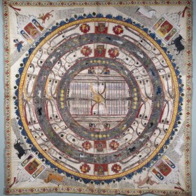
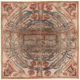
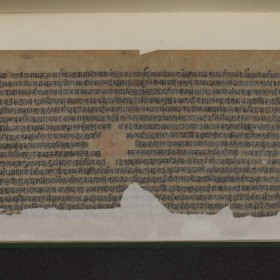
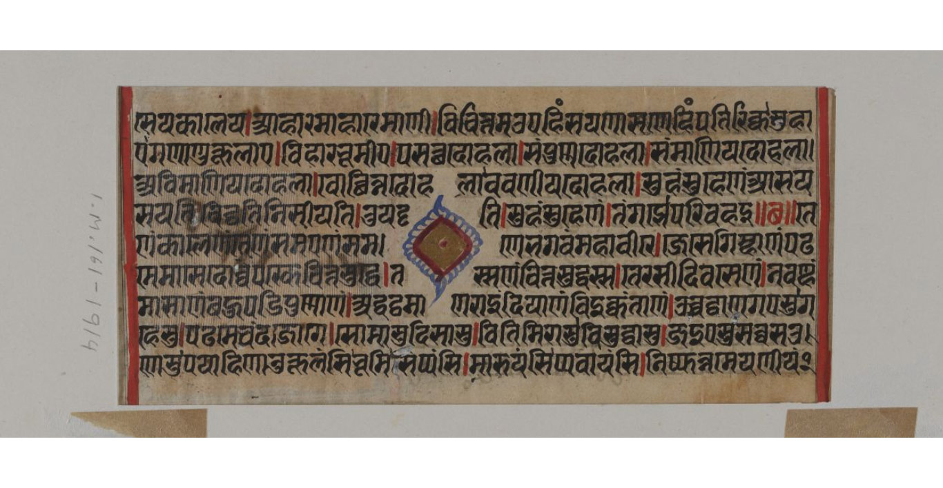
 World of mortals – detail, top right
The British Library Board Or. 13937 unknown perhaps 18th to 19th centuries
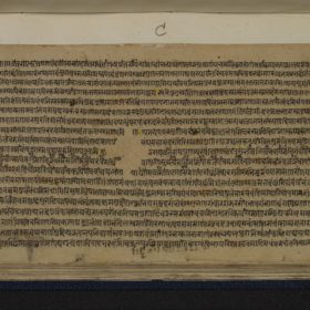
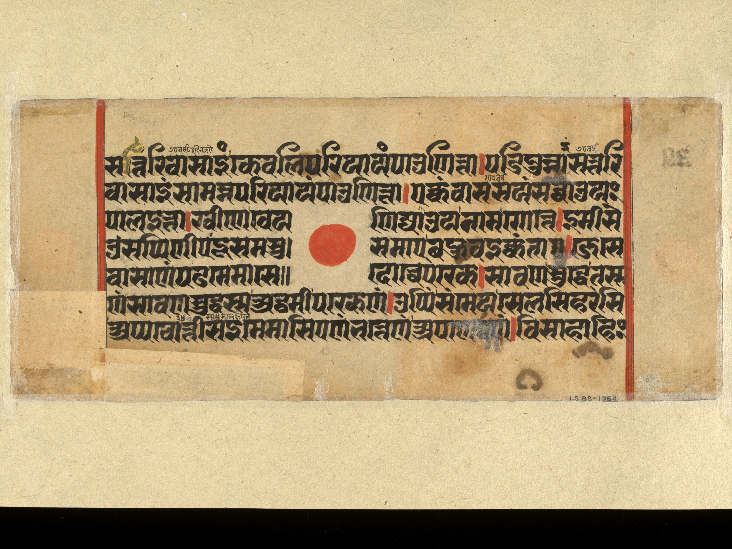
 World of mortals – detail, bottom right
The British Library Board Or. 13937 unknown perhaps 18th to 19th centuries
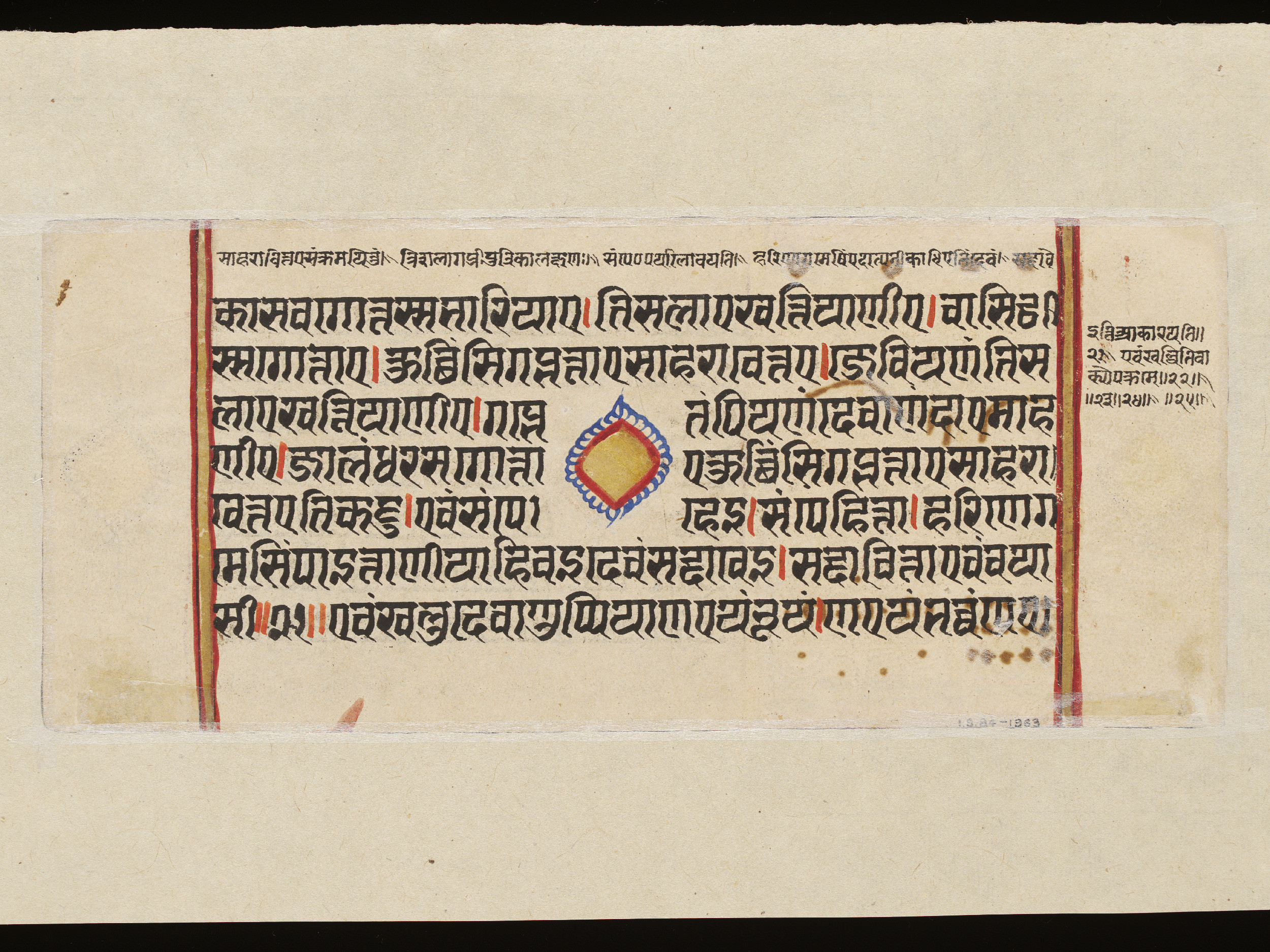
 World of mortals – detail, bottom left
The British Library Board Or. 13937 unknown perhaps 18th to 19th centuries
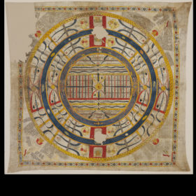
 World of mortals – detail, top left
The British Library Board Or. 13937 unknown perhaps 18th to 19th centuries